Unearthing one of Bengal's oldest cities
Location Circuits
Location Interest
Location How Many Days
Location Group
Location Content
Text Body
Few destinations in eastern India reward the curious traveller quite like the twin anchors of Balurghat and Bangarh in Dakshin (South) Dinajpur district. This is not a place of manicured tourist trails or packaged heritage walks. It is a corner of Bengal where mustard fields blaze yellow in January, the Atreyee river catches the light at dusk, migratory birds wheel over Pala-dynasty lakes and the ruins of one of ancient India’s great cities break quietly through the soil near the banks of the Punarbhaba.
Balurghat, the district headquarters, is a compact, unhurried town with a literacy rate above 91%, a lively market culture and a deep pride in its role during India’s Independence struggle. It sits on National Highway 512, the Atreyee dividing it into two uneven halves joined by a bridge. Life here moves at the pace of the river: purposeful but never rushed.
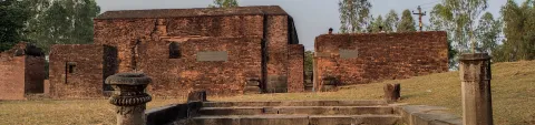
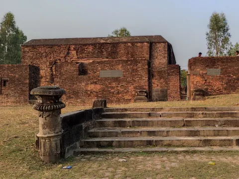
About 45km to the south, the mound of Bangarh near Gangarampur conceals one of Bengal’s most significant and undervisited archaeological treasures. Identified as the ancient city of Kotivarsha (also called Devikota), it preserves five distinct layers of civilisation: from Mauryan mud ramparts through Kushan brick walls, Gupta sculptures, Pala-era urban flourishing, to medieval Islamic occupation. Muhammad Bakhtiyar Khalji, the conqueror of Bengal, died here in 1205–06. Kushana gold coins, Buddhist monastery remains and terracotta figurines from the Shunga period have all been unearthed from its soil.
Add sacred lakes, a temple beloved on both sides of the Bangladesh border, quiet forests ideal for birdwatching, memories of the Tebhaga peasant movement and the gently surreal experience of watching trucks rumble through the India-Bangladesh land port at Hili and you have a destination that offers genuine satisfaction to those willing to look.
History
Ancient Beginnings: Kotivarsha and the Pundravardhana World
The story of this land begins not in Balurghat but at Bangarh, the ancient city known as Kotivarsha. From the evidence of the Damodarpur copper-plate inscriptions, archaeologists have established that Kotivarsha served as the administrative capital of the Kotivarsha Vishaya, a territorial division within the vast Pundravardhana Bhukti province, whose own capital was the great city of Mahasthangarh (in present-day Bangladesh). The profound influence of this region on early Indian religious culture is highlighted by the Jaina tradition, which notes that three of the four sub-schools of the Godasagana monastic order were named after Bengal cities: Tamralipika (after Tamralipti, modern Tamluk), Kotivarshiya (after Kotivarsha itself) and Pundravardhaniya (after Pundravardhana, the wider province centred on Mahasthangarh).
Excavations at Bangarh between 1938 and 1941 (led by K.G. Goswami of the University of Calcutta) and continued by the Archaeological Survey of India (ASI) have revealed five distinct cultural layers across the site. The earliest phase, Mauryan in date, shows a settlement with a modest mud-rampart wall, probably the very beginnings of what would become one of Bengal’s great cities. During the Kushana period (roughly 200 BCE – 300 CE), the city expanded dramatically: a wide brick-built rampart wall appeared, along with drains, cesspits and residential buildings of large burnt brick, all indicating a prosperous, organized urban community. Kushana gold coins have been recovered here as well as at Mahasthangarh, confirming the city’s integration into the wider sub-continental economy.
Following a relative lull in building activity during the Gupta period, the subsequent Pala era (mid-8th to 12th century) ushered in a spectacular reversal with significant urban growth. Rampart walls were rebuilt, residential quarters expanded, damp-proof granaries were constructed within housing blocks and temples were equipped with ambulatory paths for ritual circumambulation. A lotus-shaped tank, likely intended for ceremonial purposes, was constructed, featuring a pillared canopy that exemplifies the characteristic refinement of Pala architecture. Clay seals bearing Brahmi inscriptions from the Maurya period have been recovered from early excavation layers and terracotta figurines from the Shunga period attest to the artistic life of the city in its earlier centuries.
The 12th-century polymath Hemachandra compiled a remarkable list of names (Kotivarsha, Banapura, Devikota, Umavana and Shonitapura) all referring to a single city. This list is significant as it connects the archaeological site to both the Puranic legend of king Bana (son of Mahabali and devotee of Lord Shiva) and to actual place-names used throughout the medieval era. Mythology and history have always been deeply intertwined here.
Medieval Crossroads: The Islamic Period
The Sena dynasty’s patronage of Bangarh continued into the 12th century until the fateful campaigns of Muhammad Bakhtiyar Khalji, who conquered Bengal in 1204 CE and established his capital at Devkot (Bangarh). Bakhtiyar Khalji died at Devkot (Bangarh), on the eastern bank of the Punarbhaba, in 1205–06. His grave was subsequently established on the western bank of the river, where it can still be visited today. Historical accounts strongly suggest he was murdered, with his own governor, Ali Mardan Khalji, believed to be the perpetrator. His grave still stands on the riverbank, one of the most evocative and overlooked historic sites in West Bengal. The city under Muslim rule was known as Damdama and Devikot was recorded in the Ain-i-Akbari as a mahal in the sarkar of Lakhnauti, assessed at 31,624 dams in revenue.
The brick tomb of Molla Ataruddin (also known as Shah Ata), built as early as the 14th century, stands today as a rare surviving example of early sultanate architecture in the region: a square, roofless mausoleum with a stone lower portion and brick upper section. The continued administrative importance of Devkot is further demonstrated by a substantial infrastructure project undertaken by Ali Mardan's successor, Iwaz Khalji (Ghiyas-ud-din Iwaz Khalji): a wide, high-embanked road connecting Devkot to Lakhnor in the Birbhum district, with ferries provided to cross the major rivers, including the Ganges on the Lakhnor side and the Mahananda and Punarbhaba on the other.
Colonial Era, Independence and Partition
The British colonial period saw Balurghat develop as an administrative town within the sprawling Dinajpur district of the Bengal Presidency. Railways arrived, educational institutions were founded and the town grew as a local commercial hub trading in rice, jute, sugar cane and oilseeds. The town’s role in the 1942 Quit India Movement is still remembered with pride: under the leadership of Congress figure Saroj Ranjan Chatterjee, townspeople formed a procession to besiege Balurghat, before the movement was suppressed by armed police and the District Magistrate.
The Partition of India in 1947 cut the old Dinajpur district in two. The western portion remained in West Bengal and was renamed West Dinajpur; the eastern portion went to East Pakistan (now Bangladesh). This geographic wound changed Balurghat fundamentally, transforming what had been an interior town into a border settlement overnight. Traditional trade routes were severed, demographic upheaval followed and the town reinvented itself as an administrative centre. In 1992, West Dinajpur was further divided into Uttar (North) Dinajpur and Dakshin (South) Dinajpur, with Balurghat becoming the headquarters of the new southern district.
The Tebhaga Movement
The area linked to the Tebhaga movement of the 1940s, a pivotal event in Indian peasant history, is located approximately 18km from Balurghat, along the Trimohini-Patiram road. In the first half of the 20th century, most farmers worked on the land of zamindars (landlords) and were entitled to only one third of the produce. The Tebhaga movement demanded that farmers receive two thirds (‘tebhaga’ means ‘three shares’). The struggle in this region was fierce and is remembered in local consciousness. The old zamindar estate at Patiram, still standing by the Atreyee river on the Balurghat-Malda state highway, bears the memory of the Tagore family connection and offers a poignant physical reminder of the pre-Independence feudal order.
Freedom Movement Heritage, Balurghat
Balurghat played a notable role in the 1942 Quit India Movement. Balurghat holds a proud place in the district's independence history because of a local Congress procession that tried to besiege the town but was ultimately suppressed by armed police. While no formal monument marks this, local guides and the district library can point travellers toward relevant materials and memories preserved in local archives.
Title
History and Culture
Is Background Visible
Off
Location Information Items
Section Title
Top Sights and Experiences
Text Body
Getting There
By Train
Balurghat Railway Station, on the west bank of the Atreyee river, is the main rail gateway. A direct Balurghat Express runs from Kolkata (8–10 hours), with other connections via Gaur Express. Travellers from North Bengal/Northeast often change at Malda Town (76km by road, 2 hour’ drive), which connects to Kolkata and NJP. Taxis/buses run from Malda to Balurghat. Gangarampur is the rail base for Bangarh (1–2km away by local transport). The Eklakhi–Balurghat branch line serves the district.
By Road
NH 512 and SH 10 provide reliable road links.
Distances: Malda (145km, 2.5 hours); Raiganj (105km); Siliguri/Bagdogra (290km, 6–7 hours); Kolkata (440–480km, 8–10 hours). Buses operate from Malda, Raiganj and Siliguri to Balurghat. Private taxis are available from Malda or Siliguri. Within the district, hired vehicles (taxi/auto-rickshaw) are best for reaching Bangarh, Tapan and Hili.
By Air
Balurghat Airport (6km from town) currently lacks commercial services. The nearest operational airport is Bagdogra, Siliguri (290km, 6–7 hours by road). Kolkata’s Netaji Subhas Chandra Bose International Airport is another option, followed by train or bus. Check Balurghat Airport’s status before travel for potential future services.
Getting Around
Within Balurghat, auto-rickshaws and cycle-rickshaws are the main local transport, with shared autos covering primary routes cheaply. For day trips to sites like Bangarh (45km), Bolla (20km) and Hili (25km), hiring a full-day local taxi or auto is recommended for flexibility, especially on rural roads.
District roads are generally reasonable on main routes, but village lanes can slow travel. Expect conservative travel times; a 45km trip might take 1.5–2 hours. The slow pace offers pleasure through scenic mustard and paddy fields.
Bicycles, informally available for hire, are ideal for exploring Balurghat and nearby forest areas. App-based cabs are unreliable; get local taxi numbers from your accommodation.
What to Eat
Balurghat's food is traditional North Bengali, centred on rice, freshwater fish (like Rohu, Katla, Hilsa, Magur from the Atreyee and Punarbhaba rivers) and seasonal vegetables. Expect honest, flavour-driven cooking in local restaurants (or ‘hotels’) and homes.
- Macher Jhol: Simple, fragrant fish stew with rice, the regional staple.
- Panta Bhaat: Refreshing, fermented overnight rice served with onion, chilli and mustard oil; a traditional farmer's breakfast.
- Shukto: Bitter-sour mixed vegetable dish with bitter gourd, plantain and drumstick in a mustard-milk sauce; an acquired taste.
- Pitha (Rice Cakes): Rice-based cakes, popular during winter/post-harvest, found at sweet shops and festivals.
- Other Staples: Chingri Bhapa (steamed prawn), Doi Maach (fish in yogurt), Aloo Posto (potatoes in poppy seed paste).
- Sweets (Mishti): Strong North Bengal tradition; Sandesh, Roshogolla, Mishti Doi and local chhana-based sweets are widely available.
Festivals & Events
- Bolla Kali Puja: This is the district's most spectacular event, drawing up to 5 million devotees for a three-day fair and Kali Puja at Bolla village, 20km from Balurghat, each year on the Friday after Rash Purnima (Kartik full moon). The fair includes folk performances and local food.
- Durga Puja is celebrated for five days in Balurghat, with major pandals (ceremonial structures) at clubs like Avijatri, Kachikala and Srijoni Sangha, featuring processions and cultural programmes.
- Kali Puja / Deepawali is another major festival, with elaborate venues set up by clubs including Milan Sangha, Balurghat College and Yubashree Sangha.
- The Gangarampur Mela is an annual fair near Bangarh, attracting traders and visitors for local crafts and traditional Bengali culture.
- Other festivals observed in Balurghat, reflecting its multi-faith nature, include Chhath Puja, Rath Yatra, Biswakarma Puja, Ganesh Chaturthi, Saraswati Puja, Christmas and Buddha Purnima.
Best Time to Visit
November to February: Strongly recommended. Migratory birds arrive at the lakes, the Bolla Kali fair takes place in November, temperatures are ideal for exploring archaeological sites and the countryside is at its most scenic after harvest.
March to April: This is the pre-summer period with the weather warming up and spring flowers blossoming with manageable heat.
May to June: The summer months are typically hot and humid, with temperatures often reaching up to 40°C. Travel during this period is best suited for those accustomed to such climatic conditions.
July to September: The monsoon season brings heavy rainfall and lush greenery across the region. While the landscape is especially scenic during this time, caution is advised as rural roads can become difficult to navigate due to the rains.
Title
Things to Know
Is Background Visible
Off
Text Body
Bolla Kali Temple (20km)
The Bolla Ma Kali temple, the district's most cherished religious spot, is situated in the village of Bolla, which lies on the Balurghat–Malda highway. The temple’s origin story involves a zamindar arrested by the British for non-payment of taxes, who prayed to Kali and was miraculously freed the following day. Built in gratitude, the temple has grown into a site of astonishing popular devotion. The main worship day falls every Friday following Rash Purnima (typically November), when the three-day Bolla Kali Fair assembles devotees from across Dakshin Dinajpur. The temple has a dedicated room for preparing the daily bhog (ritual food offering) and prasad is distributed.
Tapan Dighi (35km)
Tapan Dighi is one of the largest water bodies in the district, located in the village of Tapan, approximately 35km from Balurghat. This large water body spans 85.30 acres, with dimensions of roughly 2km in length and 1km in width. King Laxman Sen of the Sena dynasty is said to have ordered the digging of this lake. On the northern bank of the lake is an ancient mound believed to date to the time of the Buddha, though no formal excavation has taken place there. The lake and its surroundings are a significant habitat for migratory birds in winter. A Baul Mela and cultural festival are held at Nayabazar Hattola in Tapan Block.
Mahipal Lake (60km)
The lake is attributed by local tradition to Mahipal of the Pala dynasty, most likely Mahipala I (r. c. 978–1026 CE), the great Pala revival king whose name is associated with several tanks and public works across Bengal and Dinajpur. It was excavated in the 11th century CE. It is situated 60km from Balurghat and 30km from Gangarampur. On the northern bank stand the ruins of a Nilkothi (indigo plantation house) belonging to one Mr. Thomas, a close friend of William Carey, the Baptist missionary and linguist who was also associated with Madnabati in neighbouring Malda district. The ruins of the colonial indigo house alongside a Pala-era lake creates a striking historical palimpsest. In winter, large numbers of migratory birds make this lake their temporary home.
Hili Border (25km)
The Hili land border crossing, situated in Dakshin Dinajpur, is a major international gateway between India and Bangladesh. It serves as a vital hub for Indo-Bangladesh trade, with hundreds of trucks transporting goods across the border in both directions daily. For travellers who have not previously seen a land border between India and Bangladesh, the experience of watching the frontier up close, with the road simply changing country a few hundred metres ahead, is quietly arresting. The approach road from Balurghat passes through flat agricultural country and offers a vivid illustration of how borders cut through what was once undivided Bengal. There is a small forest and picnic spot at Sarongbari near Hili.
Khanpur & Surroundings
Khanpur is a frequently mentioned local spot for a relaxed outing, offering paddy-field scenery and quiet riverside access. It is best explored as part of a countryside drive or combined with a visit to another site.
Title
Nearby Excursions
Is Background Visible
Off
Location Images
Image
Location Banner Image
Image